
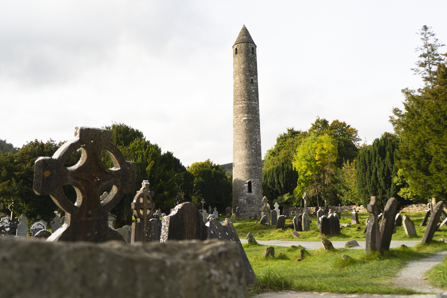
Glendalough Monastic City, the end of Saint Kevin’s Way
Ireland has a rich history of traditions, worship, and folklore. This deep well has created and inspired many a walk - be it purely the necessities of everyday life that become ritual, or a pilgrimage that takes walkers across the sea to see its completion. Over the past nine years, I’ve walked four (or so) Irish routes and encountered many others that contain elements of pilgrimage, and have become fascinated by the sudden rise of more of these trails.
Celtic Caminos
The Irish Camino Society has a list of routes that have been approved as trails to walk ahead of continuing on to Spain to complete a pilgrimage to Santiago de Compostela.
“The Camino Society Ireland is a voluntary organisation, founded in 1992 by returned pilgrims to ‘give something back’ to the Camino and to future pilgrims…. We offer an opportunity to all those interested in the Camino to meet and share practical information and experiences, especially with those intending to travel. We are non-political, non-profit, non-sectarian and non-denominational, encompassing all of Ireland and open to all. We foster an understanding and appreciation of the Camino’s related history, art, architecture and music.”
Currently, they have 10 recommended routes all around the island of Ireland. If you’re interested in walking one of these routes as part of completing a pilgrimage to Santiago de Compostela in Spain, you will need to walk a minimum of 25km (all of these routes meet or exceed that), and then call into their office at St. James’s in Dublin to collect an Irish Compostela, which certifies those 25km.
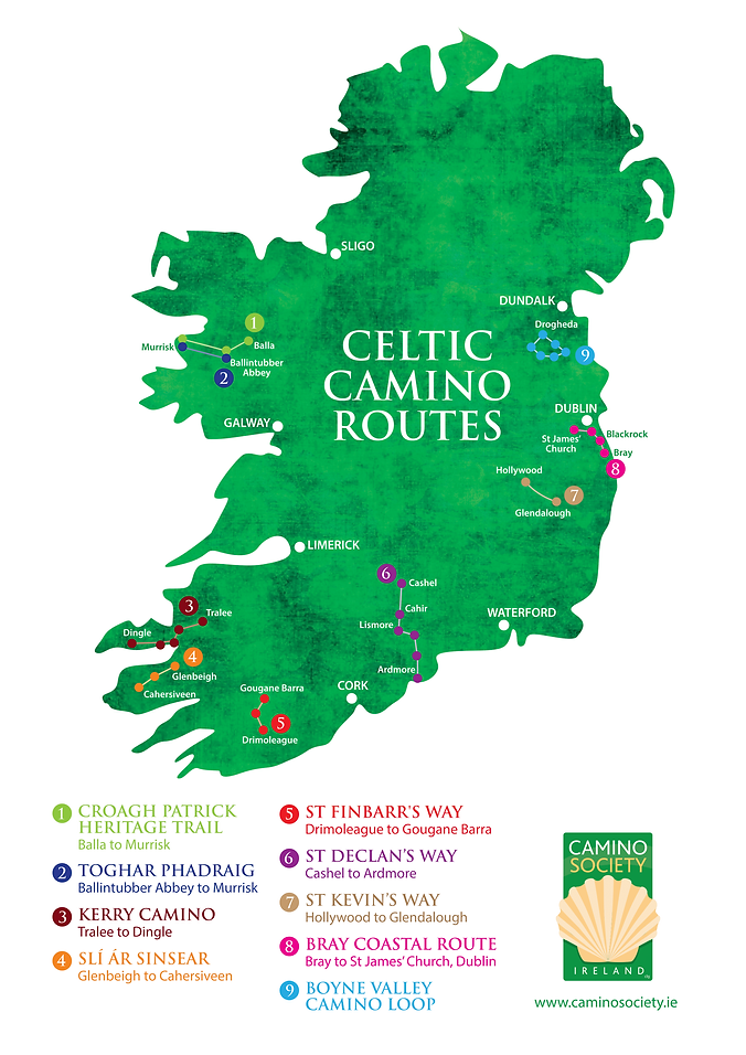
Celtic Camino Routes
1. Croagh Patrick Heritage Trail, Mayo
2. Tóchar Phádraig, Mayo
3. Kerry Camino, Kerry
4. Slí ár Sinsear, Kerry
5. St. Finbarr’s Way, Cork
6. St. Declan’s Way, Tipperary - Waterford
7. St. Kevin’s Way, Wicklow
8. Bray Coastal Camino, Wicklow - Dublin
9. Boyne Valley Camino, Louth
10. Coalisland Camino, Tyrone (very new so not included in overview image)
However, there are also the Pilgrim Paths of Ireland, which is another list of routes around the country inspired by the idea of walking as pilgrimage. While there are no specific distinctions between the two lists, the more time I’ve spent with their trails, the closer I am to a vague overview.
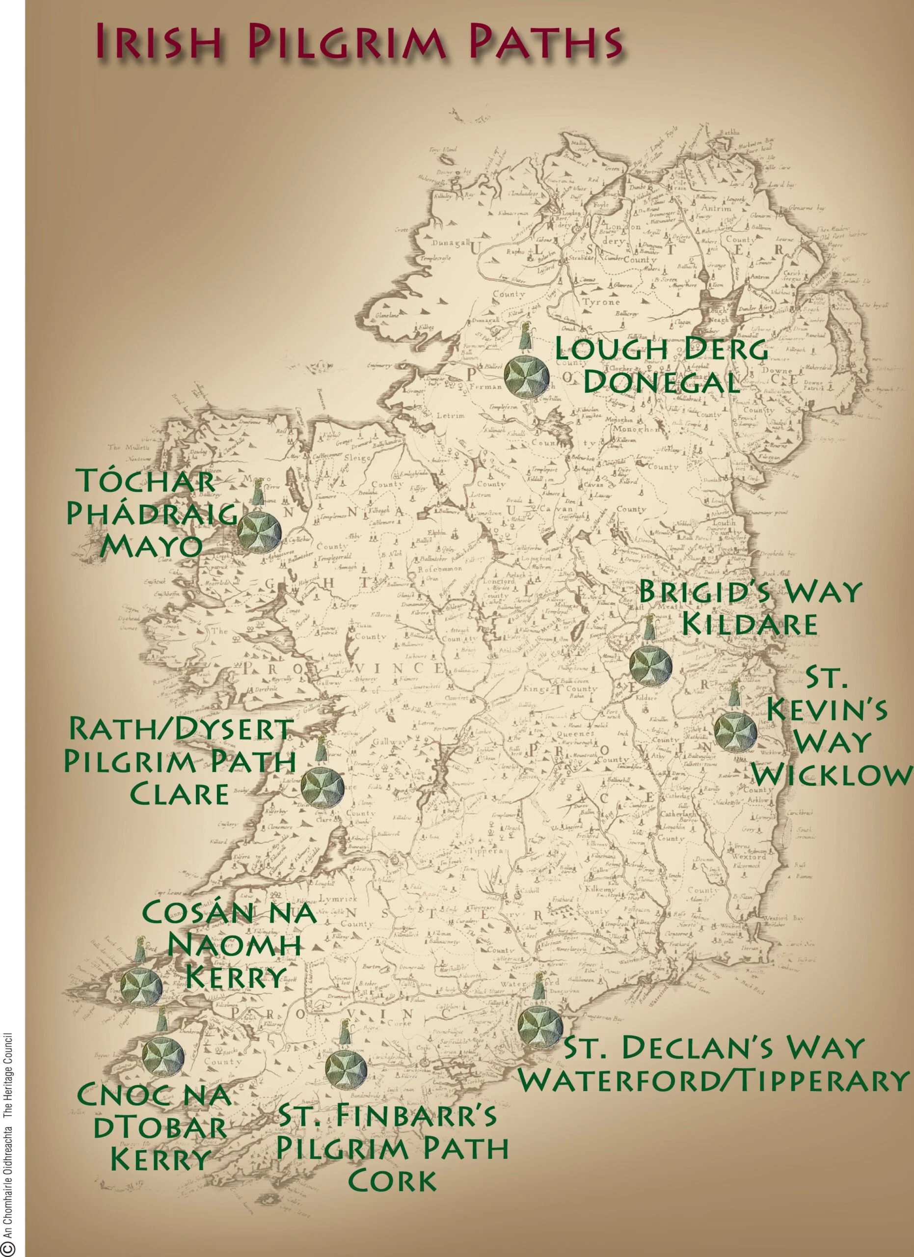
Pilgrim Paths of Ireland
1. Tóchar Phádraig, Mayo
2. Lough Derg, Donegal
3. Brigid’s Way, Kildare
4. St. Kevin’s Way, Wicklow
5. St. Declan’s Way, Tipperary - Waterford
6. St. Finbarr’s Way, Cork
7. Cnoc na dTobar, Kerry
8. Cosán na Naomh, Kerry
9. Dysert Pilgrim Path, Clare
Pilgrim Paths of Ireland
My reading of the current list of the Pilgrim Paths of Ireland is that they are spiritual walks based on routes that were completed in penance (like the stations of the cross), or in the footsteps of a saint. These paths give me the impression of being more about the spiritual act of pilgrimage, and less about the enjoyment of a quality trail.
However, a handful of these trails were developed decades ago as part of the Walks Scheme, and are legitimate, wonderful walks.
The Celtic Camino Routes of Ireland is a more recent phenomenon, inspired by how walking the Camino de Santiago in Spain has transformed the concept of a walking holiday, and had such a distinct impact in Ireland. I don’t mean to imply that these routes are less grounded in the history or the land they traverse - many also follow in the footsteps of famous Irish saints walking (like St. Kevin’s Way featuring on both lists), and some have been built off of records found of people sailing from there to Spain to complete their pilgrimages (such as the Boyne Valley Camino and the Kerry Camino). I’ve typically found that the trails on the Celtic Camino routes ensure there is a certain quality to the walking, and so more of these routes are developed to a Sport Ireland accreditation standard, while some of the pilgrim paths are descriptions of walking routes on roads with little signage.* So far, I’ve done more Celtic Camino’s than Pilgrim paths. And I’ve a suspicion that some of the best routes might be the ones that have made it onto both lists.
*There are, of course, exceptions to these generalisations; such as the Bray Coastal Camino has basically no way-marking, and just a PDF that describes the road directions (I think this is because the route follows roads with footpaths, so it didn’t need to be formalised as such, which is a whole other thing); and I think there’s been a push to make the pilgrim paths more official from the Heritage Council, Sport Ireland, and Rural Recreation Officers, and so better information has been appearing about the routes in the last 12 months or so.
Trail Overviews
Here’s a run down of the different routes, either reflecting on my own experience of the route, or the research I’ve done on them so far. I’m mixing the two lists below, as some trails are on both. I’m starting with Mayo, and working my way clockwise around the island.
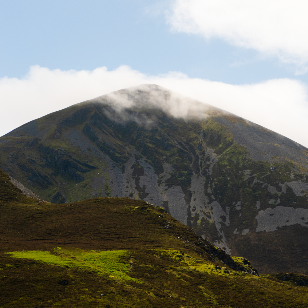
1. The Croagh Patrick Heritage Trail, Co. Mayo
Distance: 63km
Duration: 2 - 3 Days
Trail Grade: Easy - Moderate
List: Celtic Camino Route
Way-marking: yellow arrow on black background
Description: The Croagh Patrick Heritage Trail is a 63km linear walk from Balla to Murrisk, in County Mayo. Passing through fields, boreens, and small sections of deciduous woodland, this trail links religious and ancient sites that all revolve around the worship of the mountain Croagh Patrick and the saint of the same name.
The final section includes climbing onto the shoulder of the Reek, before the trail descends towards the village of Murrisk on the coast. Some walkers like to continue climbing the mountain before descending into the village, but this is not officially part of the route.
Read the full write-up here | Watch the video
Official Trail Website | Sport Ireland Trail Overview
Find the GPX on HiiKER | Buy the physical map from EastWest Mapping
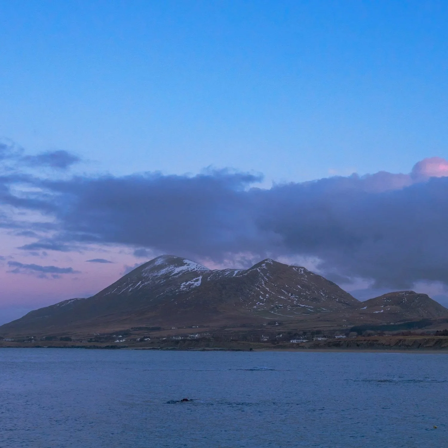
2. Tóchar Phádraig, Co. Mayo
Distance: 35km
Duration: 1 - 2 Days
Trail Grade: Easy - Moderate
List: Celtic Camino Route & Pilgrim Path
Way-marking: yellow arrows on wooden posts
Description: Similar to the Croagh Patrick Heritage Trail discussed above, the Tóchar Phádraig finishes on the Reek. However, this walk begins at Ballintubber Abbey, almost 30km closer to the holy mountain. The two trails criss-cross each other as they both work their way west, with the Tóchar Phádraig taking a slightly straighter route. To walk the route and obtain a pilgrim passport and pilgrim stamps, walkers are required to register with Ballintubber Abbey, and pay €30pp to walk as well as €5 for the passport.
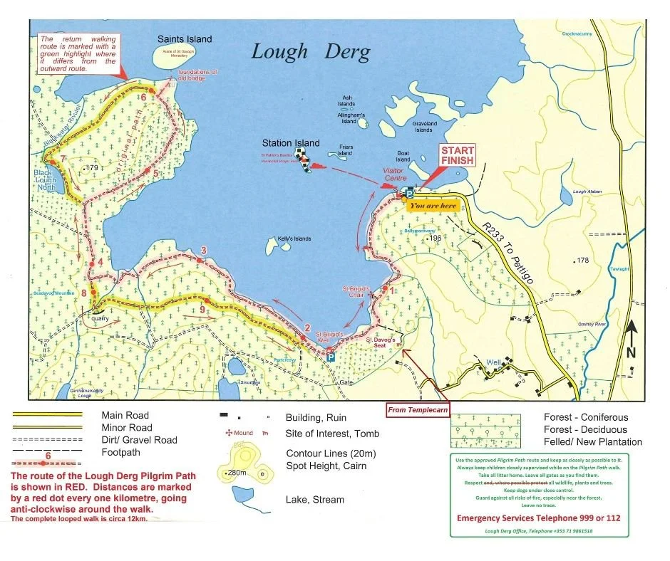
3. Lough Derg, Co. Donegal
Distance: 12km
Duration: 2 - 4hrs
Trail Grade: Easy
List: Pilgrim Path
Way-marking: yellow arrow on black background
Description: This one was such a surprise for me - I didn’t know that there was a Lough Derg in Donegal (as I previously spent 3 days walking around another Lough Derg in Limerick), never mind that the lake has an island home to a large monastery (the Sanctuary of Saint Patrick) that people would go to on a multi-day pilgrimage. Up until 2020, completing the pilgrim route here involved travelling to the island and undertaking a spiritual retreat. However, they have now developed a 12km trail along the lakeshore, which:
“follows in the footsteps of the medieval pilgrims — not to Station Island where pilgrims normally go today, but to the threshold of the larger Saints Island, which acted as its gateway several hundred years ago. The focus of the legendary St Patrick’s Purgatory, Station Island, was a deep pit in which those who spent a day and a night would allegedly be purged of their sins, experiencing both the torments of the damned and the delights of the blessed” - Pilgrim Paths of Ireland
Find the GPX on HiiKER | Read more on the Monastery Website | Sport Ireland Trail Overview
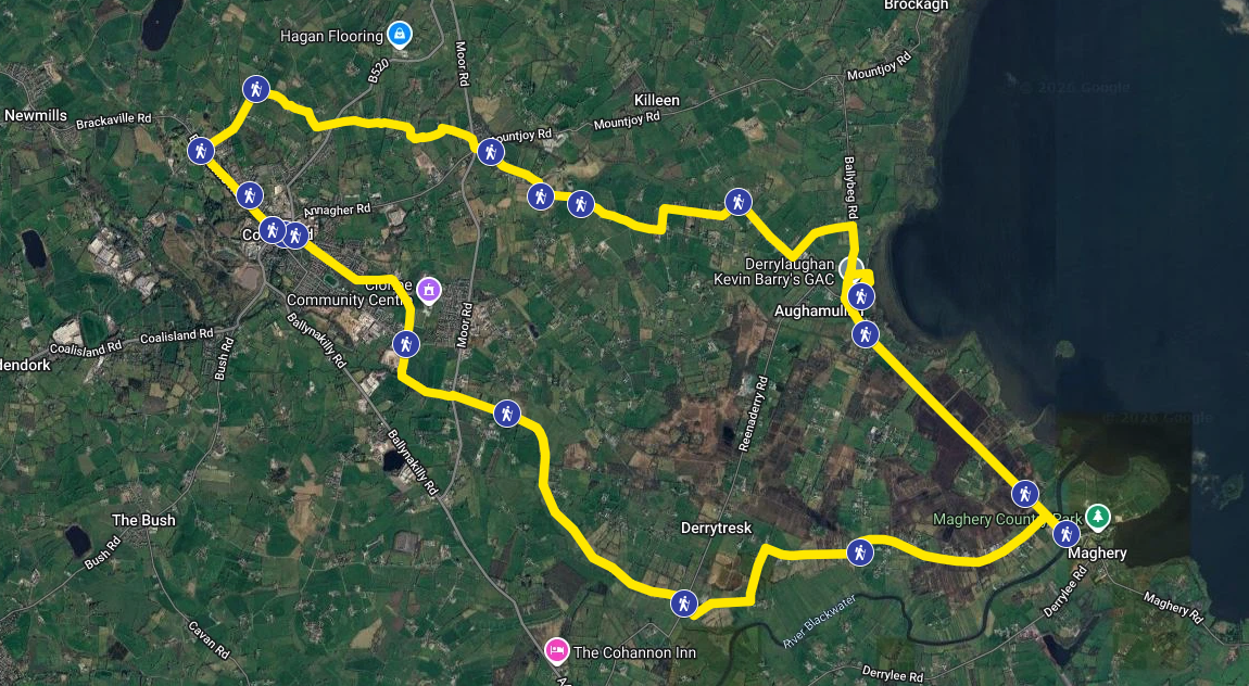
4. Coalisland Camino, Co. Tyrone
Distance: 26km
Duration: 1 Day
Trail Grade: Easy
List: Celtic Camino Route
Way-marking: unknown
Description: This is the newest Celtic camino route to come to the island of Ireland. This camino has been developed after members of the Friends2Talk mental health group walked in Spain and were inspired by their experience:
“Recognising the transformative impact such a pilgrimage can have on emotional and mental well-being, they envisioned creating a local Camino rooted in the landscape, culture, and history of Coalisland and its surrounding areas. With aid from The National Lottery Community Fund, Friends2Talk created the Coalisland Camino.” - Coalisland Camino Website
I have not walked this route, however based on my research the first 7km follow the Coalisland Canal Walk, and the remaining 19km are all along rural roads. The group developing the trail have clearly put in a lot of work, as there appear to be at least 13 (maybe 18) stamps that you can collect along the way (some may only be available during organised group walks). There does not seem to be any way-marking on the ground, but there is a Google Maps route and written description of the walk on the website.
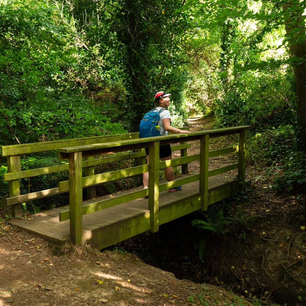
5. Boyne Valley Camino, Co. Louth
Distance: 25km
Duration: 1 Day
Trail Grade: Easy
List: Celtic Camino Route
Way-marking: yellow arrows, yellow shell on a blue background
Description: Starting in Drogheda, the trail is shaped like a figure-eight. The route starts by heading west along the northern side of the River Boyne to Townley Hall Woods, the centre of the eight shape. This is where the trail crosses itself - continuing on you will now be on the south-west side of Townley Hall Woods. Once at Mellifont Abbey, you return through the village of Tullyallen and the northern side of the woods. Making it back to the trail junction, the route takes you along the south side of the River Boyne on the gorgeous greenway all the way into the centre of Drogheda.
This is a very accessible walk, with no stiles, but some steps and forest trails. This figure-eight format means that you can split the trail into two 13km loops, which is great for anyone building up to walking longer days. It does feature more road walking than some might like, but when I walked the route, it really reminded me of walking Camino routes across Spain, which is a pretty good indicator to me!
Read the full write-up here | Watch the video
Find the GPX on HiiKER | Official Trail Website | Sport Ireland Trail Overview
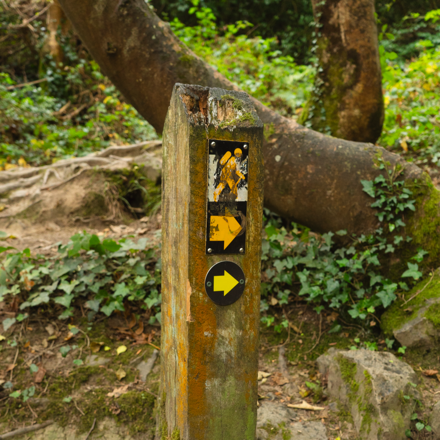
6. Bray Coastal Camino, Co. Wicklow - Dublin
Distance: 30+km
Duration: 1 - 2 Days
Trail Grade: Easy
List: Celtic Camino Route
Way-marking: limited / no way-marking
Description: The Bray Coastal Camino is one of the less well developed routes from the Celtic Camino list. Starting on the Bray seafront, there’s a general description of a route in the PDF overview (linked below) that takes you up along the coast of Dublin City, all the way into the docks and back along the River Liffey, until you arrive at St. James's Gate and the Camino Society’s office. There is almost no way-marking, apart from a couple of camino shells placed haphazardly throughout the total distance. Possibly one of the reasons that there’s not a more formal route is that the whole “way” follows roads with footpaths. Despite these possible negatives, I am still excited to walk this myself, and have been collecting a list of places to stop at to collect stamps.
PDF Overview of the Route | Learn more from the Camino Society
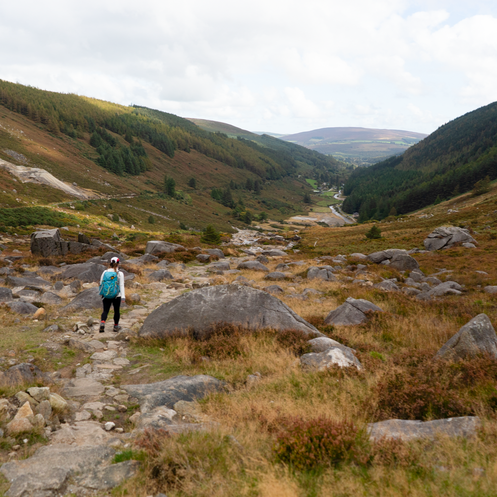
7. St. Kevin’s Way, Co. Wicklow
Distance: 26km
Duration: 1 - 2 Days
Trail Grade: Easy - Moderate
List: Celtic Camino Route & Pilgrim Path
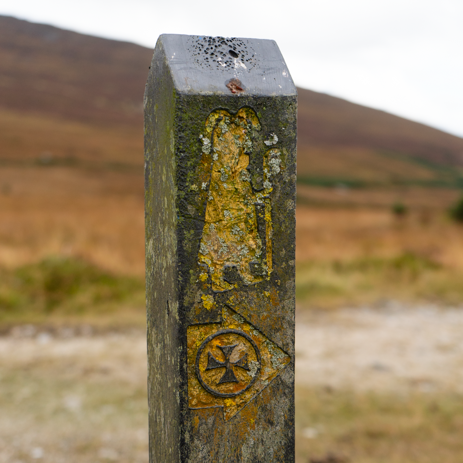
Way-marking: yellow arrow on black background, with saint figure
Description: St. Kevin’s Way is an ancient path, said to follow in the footsteps of the Irish saint as he travelled through Wicklow to find a remote corner of nature for his hermitage. Reputedly born in 498AD, there is little that can be said for definite on his life, but he has inspired many tales in this area, and borne a beautiful walking trail.
Read the full write-up here | Watch the video
Find the GPX on HiiKER | buy the physical map from EastWest Mapping | Sport Ireland Trail Overview
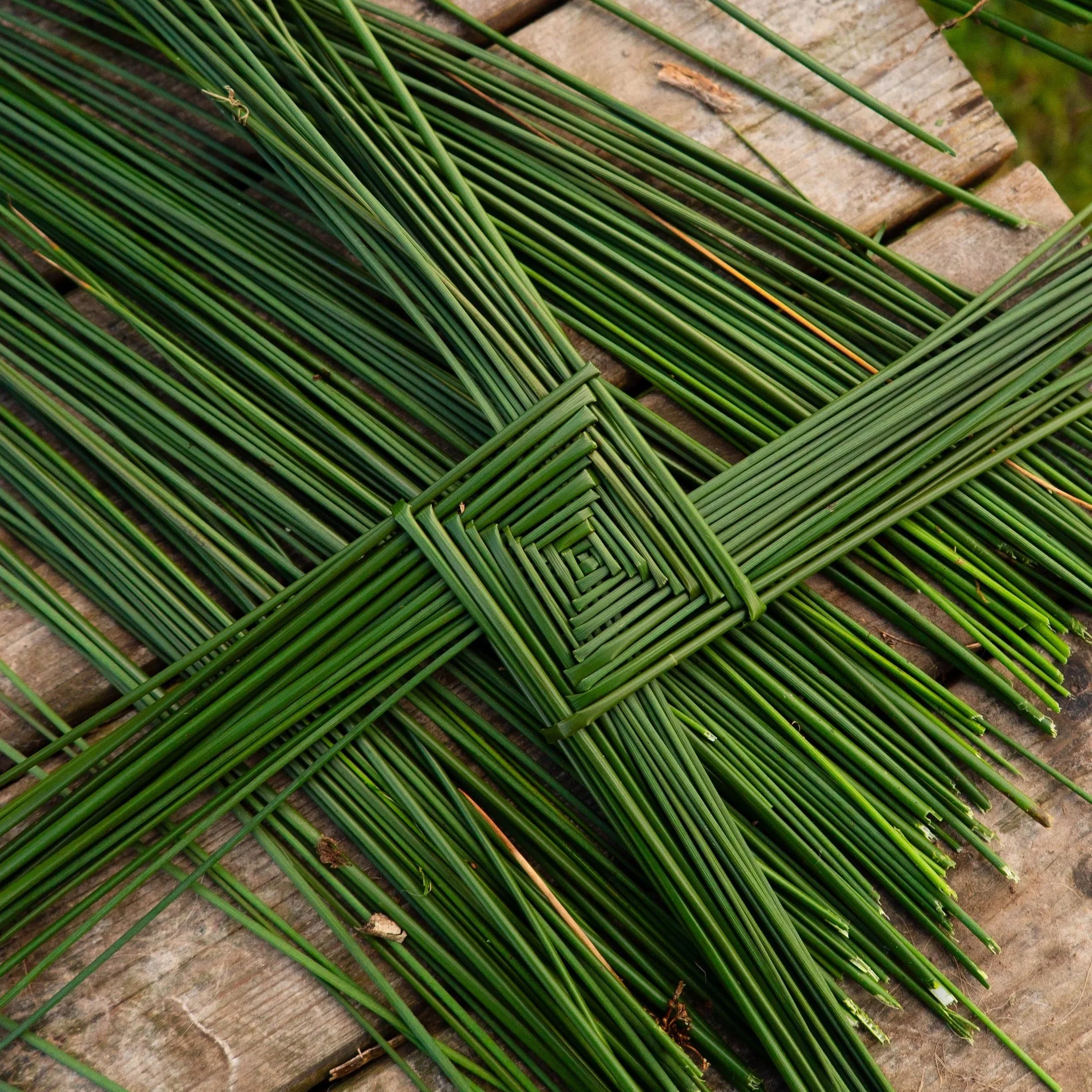
8. Brigid’s Way, Co. Kildare
Distance: 152km
Duration: 6 - 9 Days
Trail Grade: easy
List: Pilgrim Path
Way-marking: none
Description: Brigid’s Way seems to be the least developed route on this list. It is entirely along roads (including National roads), has no way-marking and no accreditation.
This trail has been developed by a group who want to explore the spiritual side of walking, and have linked together many sites associated with or named after St. Brigid. They run group events along the route they have put together. I look forward to the possibility of this being developed into a more formal trail.
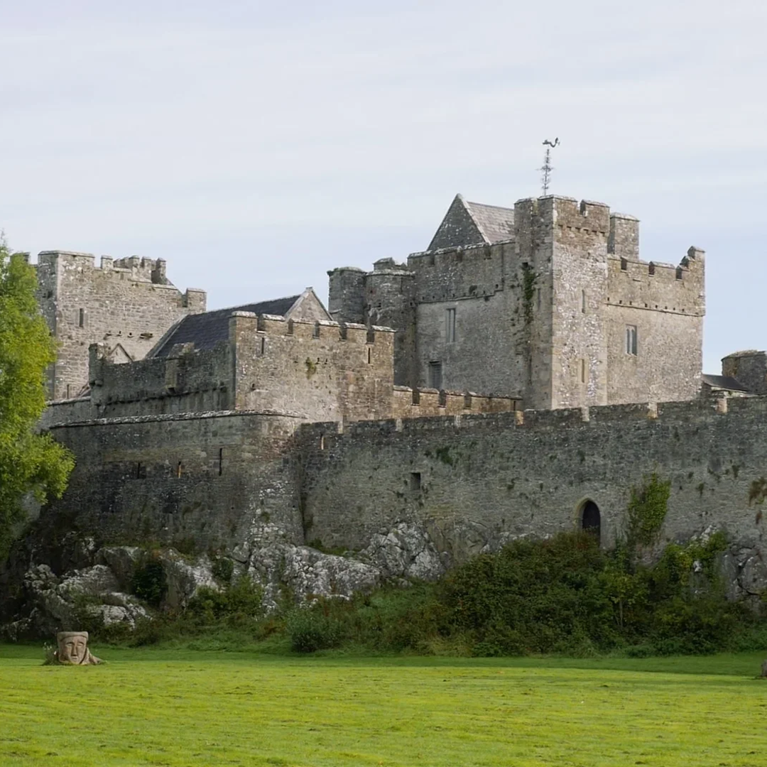
9. St. Declan’s Way, Co. Tipperary - Co. Waterford
Distance: 117km
Duration: 4 - 6 Days
Trail Grade: Easy - Moderate
List: Celtic Camino Route & Pilgrim Path
Way-marking: Blue arrow with SDW wording
Description: St. Declan’s Way has been on my to do list since 2019, and by all accounts it is a really nice trail! Taking you from Cashel to Ardmore, this walk crosses the Tipperary Heritage Way and the East Munster Way, climbing the tail end of the Knockmealdown Mountains before finally reaching the coast at Ardmore. The official website writes that St. Declan’s Way has been developed as:
“a modern route which follows a number of ancient pilgrim pathways including St. Declan’s Road, Casán na Naomh (path of the saints), Bóthar na Naomh (road of the saints) and the Rian Bó Phadraig (track of St. Patrick’s cow). The route was first described in detail by Canon Patrick Power in 1905. Ardmore Enterprise Co-operative produced a wonderful map brochure in 1994 which is still in circulation. The brochure lists 64 sites of historic, natural and archaeological significance along St. Declan’s Way. The route shown was also described by Siobhan Lincoln of Ardmore in her book ‘Along St. Declan’s Way.’”
find the GPX on HiiKER | Sport Ireland Trail Overview | Official Website
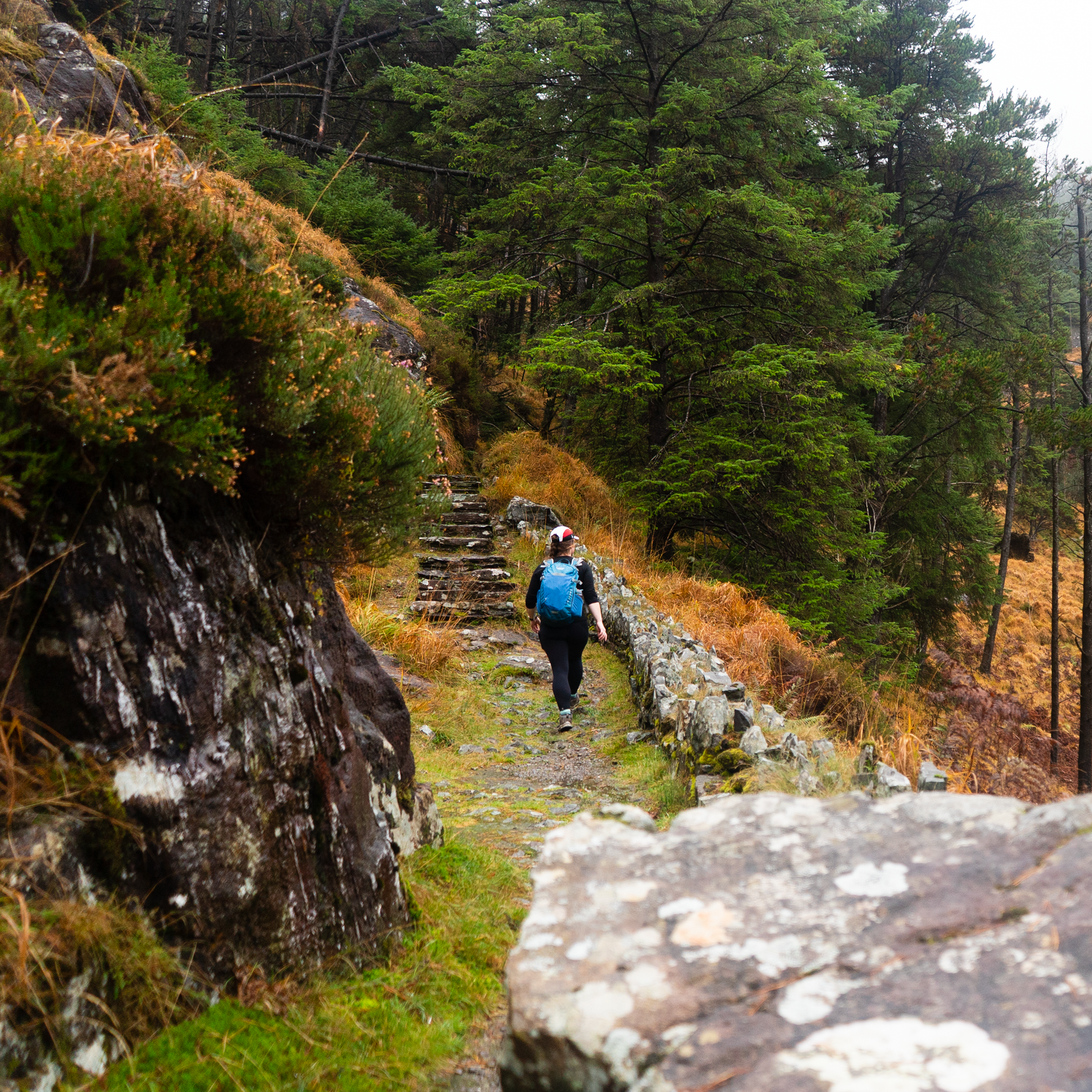
10. St. Finbarr’s Way, Co. Cork
Distance: 36km
Duration: 1 - 2 Days
Trail Grade: Moderate
List: Celtic Camino Route & Pilgrim Path
Way-marking: yellow arrow on black background, with saint figure
Description: St. Finbarr’s Way is one of the older pilgrim paths that I know about - it was actually one of the original six pilgrim paths that was officially developed as part of the Walks Scheme (which is something that I can usually use as a guide to know that this will be a good trail). According to the Sheep’s Head Way website (which has so much information about trails all over West Cork), the history of walking to St. Finbarr’s hermitage in Gougane Barra has been around for centuries, with local tradition recalling that St. Finbarr “arrived at the Top of the Rock in the sixth century and admonished the people to return to Christ, after which he made his way to Gougane Barra.”
While the Sport Ireland overview isn’t extensive, what it does say rings loud; “St. Finbarr's Way provides two days of outstanding scenery, fascinating heritage and folklore, and a truly breath taking descent into the ancient hermitage of Cork's most famous Saint.” I am really looking forward to getting to walk this trail sometime soon.
find the GPX on HiiKER | Sport Ireland Trail Overview | Sheep’s Head Way Website
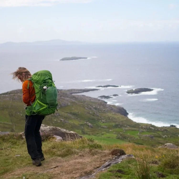
11. Slí ár Sinsear, Co. Kerry
Distance: 29km
Duration: 1 - 2 Days
Trail Grade: Easy - Moderate
List: Celtic Camino Route
Way-marking: none
(partially follows Kerry Way which is yellow arrow on black background)Description: This route follows much of the Kerry Way from Glenbeigh to Cahersiveen, with a couple of minor detours, and so I have walked much of it, even if I wasn’t aware of its existence at the time. This area is beautiful; walking along stretches of open hillsides and with stunning views of the coast and the Dingle Peninsula.
As far as I’m aware, there are no specific way-markers for this route, and so you need to pay close attention to the route notes (linked below), so you know when to detour off from the Kerry Way.
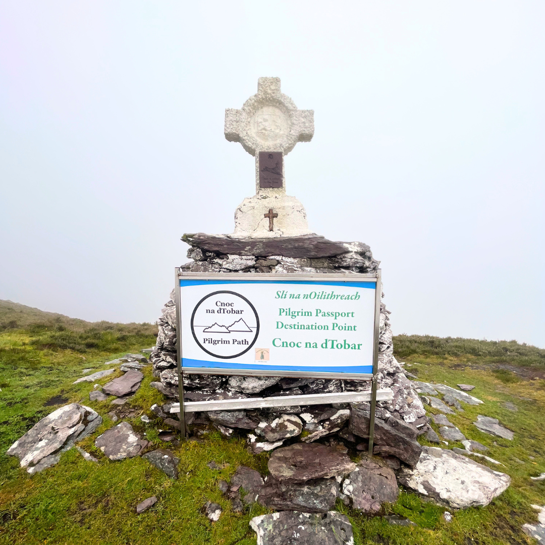
12. Cnoc na dTobar, Co. Kerry
Distance: approx. 8km total and 690m of elevation
Duration: 2 - 4hrs
Trail Grade: Moderate
List: Pilgrim Route
Way-marking: Large white crosses and informal markers
Description: So technically I’ve already done this route when completing the Vandeleur-Lynams Mountain Project (on day 45). Along a boreen heading to Coonanna Harbour, there’s a small, rustic carpark on the right. From here, there are signs and stations of the cross all the way up to the summit. The path underfoot is rough - made from the passage of people rather than built for walking. On a good weather day, the views are gorgeous. While now a more Christian-focused pilgrimage, there are centuries of history associated with this mountain.
Watch the video (Vandeleur-Lynams Reel)
find the GPX on HiiKER | Read more on the Pilgrim Paths website
13. The Kerry Camino, Co. Kerry
Distance: 60km
Duration: 3 Days
Trail Grade: Easy
List: Celtic Camino Route
Way-marking: yellow arrow on black background
Description: The Kerry Camino follows the first three stages of the Dingle Way. The story goes that Saint Brendan (born along the North Kerry Way) travelled from Dingle and across the seas to spread Christianity, eventually reaching North America. Pilgrims in the past would also sail from Dingle to Spain to walk the Camino de Santiago, so Dingle is a fitting place for the Kerry Camino.
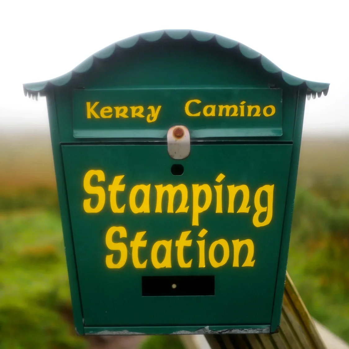
What was most noticeable from the very start of the walk, was that the Kerry Camino has added extra infrastructure to the trail in the forms of extra signage, benches, and stamping stations - of which you need a minimum of 8 stamps to get a certificate at the end in Dingle.
Read the full write-up here | Watch the video
Find the GPX on HiiKER | Buy the physical map from EastWest Mapping | Official Trail Website | Sport Ireland Overview for the Dingle Way
14. Cosán na Naomh, Co. Kerry
Distance: 18km
Duration: 1 Day
Trail Grade: Easy
List: Pilgrim Path
Way-marker: yellow arrow on black background, with saint figure
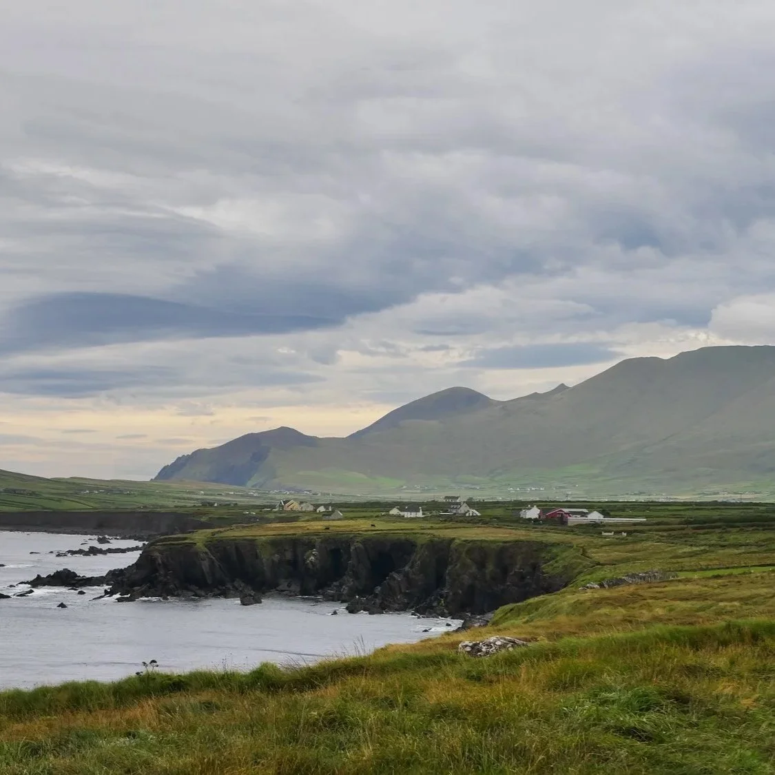
Description: Cosán na Naomh (the Saints Road), is by all accounts a lovely walk inland from Ventry to the base of Mount Brandon on the Dingle Peninsula. Sport Ireland writes that:
Cosán na Naomh is one of Ireland's most fascinating and beautiful old pilgrimage roads. It presents no major challenge, even for the casual walker, as it only climbs one hill and otherwise weaves its way gently up and down from the beach at Ceann Trá (Ventry) to the foot of Brandon Mountain. The scenery is spectacular with a constant vista of sea or mountain and often both.
However, I have also read that (similar to the pilgrimages around Croagh Patrick), while the route doesn’t officially go up to the summit, it intends to leave that option open to you. A few years ago at a MountainViews Gathering I listened to a fascinating talk all about the long history of pilgrimage associated with Mount Brandon (and how much it became a huge local industry, with locals working as guides and running hostels, reminding me somewhat of what Spain is like these days).
What might make an interesting loop would be to link this with the Dingle Way and make a long-weekend loop around the western end of the peninsula.
Find the GPX on HiiKER | Buy the physical map from EastWest Mapping | Sport Ireland Trail Overview
15. Dysert Pilgrim Path, Co. Clare
Distance: 8km
Duration: 2 - 3hrs
Trail Grade: Easy
List: Pilgrim Path
Way-marking: none
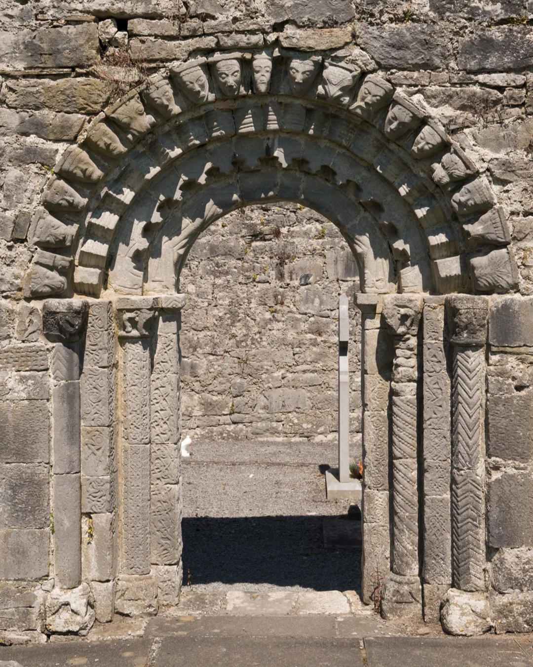
Description: I have not walked this route, but I have walked the Mid Clare Way, which I think shares some small sections. I found the written directions for this path extremely hard to line up with any maps I was looking at, so whether the route is 8km, and where it goes exactly, is unclear to me. However, in this general area there are some incredibly old churches, round towers, and high crosses that I think are worth a visit if that is something you’re interested in, such as Dysert O’Dea Church or Quin Friary.
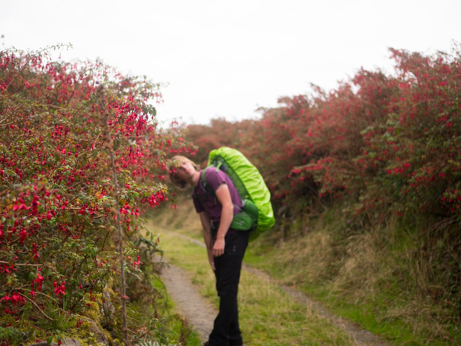
The Kerry Camino, Dingle
Reflections on the trails:
Routes that are on my To-Do list:
St. Finbarr’s Way, Co. Cork
Bray Coastal Camino, Co. Dublin
St. Declan’s Way, Co. Tipperary
Cosán na Naomh, Co. Kerry
Tóchar Phádraig, Co. Mayo
My favourites that I’ve walked:
As you can see, there’s a real mix between all these routes - some are trails with history, others are new passion projects by locals. Wherever you end up, I think you will have a memorable experience. Excluding the Bray Coastal Camino, any routes that I mention that do not having their own way-marking: I would recommend holding off on walking until the routes have been vetted and approved for walking. All access to land in Ireland is built on permissive access agreements, and takes a lot of work from Rural Recreation Officers and Local Authorities.
Let me know if there are other pilgrimage routes that you’ve come across (eg. I know there’s a Mass Path route across the Sheep’s Head Peninsula) and would recommend me exploring!